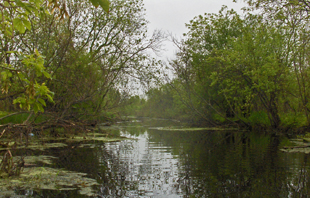
The total watershed area is 82 km² or 8,235 ha and the total watercourse length is 100 km.
Stoney Creek
Stoney Creek is a significant watercourse located east of Lindsay, Ontario. It flows southwest through Reaboro, passing under Highways 7 and 35, before draining into East Cross Creek.
The Stoney Creek watershed encompasses approximately 82 square kilometers, with a total watercourse length of 100 kilometers. The area is characterized by 36% natural vegetation cover, predominantly mixed forests. This includes 468 hectares of forest interior and 37 hectares of deep forest interior, providing essential habitats for various plant and animal species.
Significant ecological features within the watershed include the East Cross Creek No.15 Provincially Significant Wetland, covering 854 hectares, and the Stoney Creek Headwaters Provincially Significant Wetland, spanning 597 hectares. Additionally, the East Cross Creek Area of Natural and Scientific Interest (ANSI) encompasses 16 hectares, highlighting the region's ecological importance.
Environmental assessments indicate that the surface water quality of Stoney Creek is rated as poor, with total phosphorus concentrations averaging 0.079 mg/L, exceeding the provincial objective of 0.03 mg/L for rivers and streams. The health of benthic macroinvertebrate communities, as measured by the Family Biotic Index (FBI), is not available. Forest conditions within the watershed are rated as fair, reflecting the need for conservation efforts to enhance the area's natural environment.
Understanding the characteristics and environmental conditions of Stoney Creek is essential for effective watershed management and conservation initiatives, ensuring the preservation of its ecological integrity and the health of the broader East Cross Creek ecosystem.

Watershed characteristics
Learn about the characteristics of the Stoney Creek watershed.
The dominant forest type is mixed forest including:
- Forest interior (100 m): 468 ha
- Forest interior (200 m): 37 ha
- Natural cover: 36 %
Provincially Significant Wetlands
- East Cross Creek No.15: 854 ha
- Stoney Creek Headwaters: 597 ha
Area of Natural and Scientific Interest (ANSI) - Life Science: East Cross Creek: 16 ha
Environmental conditions
The following grades show the environmental conditions for the Stoney Creek watershed.
| Indicator | Result | Grade | Status |
|
Total phosphorus |
0.079 mg/L |
D |
Poor |
|
Benthic macroinvertebrates |
N/A |
N/A |
N/A |
The surface water quality grade was based on total phosphorous (TP) and/or benthic macroinvertebrates (aquatic insects) family biotic index (FBI). The provincial water quality objective for TP in rivers and streams is 0.03 mg/L and 0.02 mg/L in lakes. These guidelines were set because levels highter than these guildelines provide conditions for nuisance algae and aquatic plant growth. A TP value below 0.03 mg/L (rivers) or 0.02 (lakes) meets the provincial guidelines and is in the B (good) or A (excellent) grade range, while the result for benthic macroinvertebrates must be 5.00 or lower to receive a B (good) or A (very good to excellent) grade.
| Indicator | Area cover | Percent cover | Grade | Status |
|
Forest cover |
19.7 km² |
23.9% |
C |
Fair |
|
Forest interior |
5.0 km² |
6.1% |
C |
Fair |
|
Forested riparian cover |
1.9 km² |
31.7% |
C |
Fair |
The combined forest conditions grade for Stoney Creek is ranked as fair.
| Indicator | Area cover | Percent cover | Grade | Status |
|
Wetland cover |
18.1 km² |
22% |
A |
Excellent |
Contact Us
Kawartha Conservation
277 Kenrei Road
Lindsay, ON K9V 4R1
Tel: 705.328.2271
Fax: 705.328.2286
Subscribe to Receive Updates and Notifications
Stay up to date on flood and low water, news, activities, events, programs and operations by subscribing to updates and the Watershed Watch Newsletter.
