Located north of the village of Bobcaygeon this creek outlets to Big Bob Channel. West of the dam this channel is separated from Big Bob Channel by a concrete barrier.
Flood Plain Mapping
What is a flood plain?
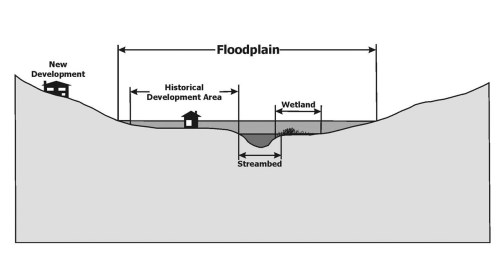
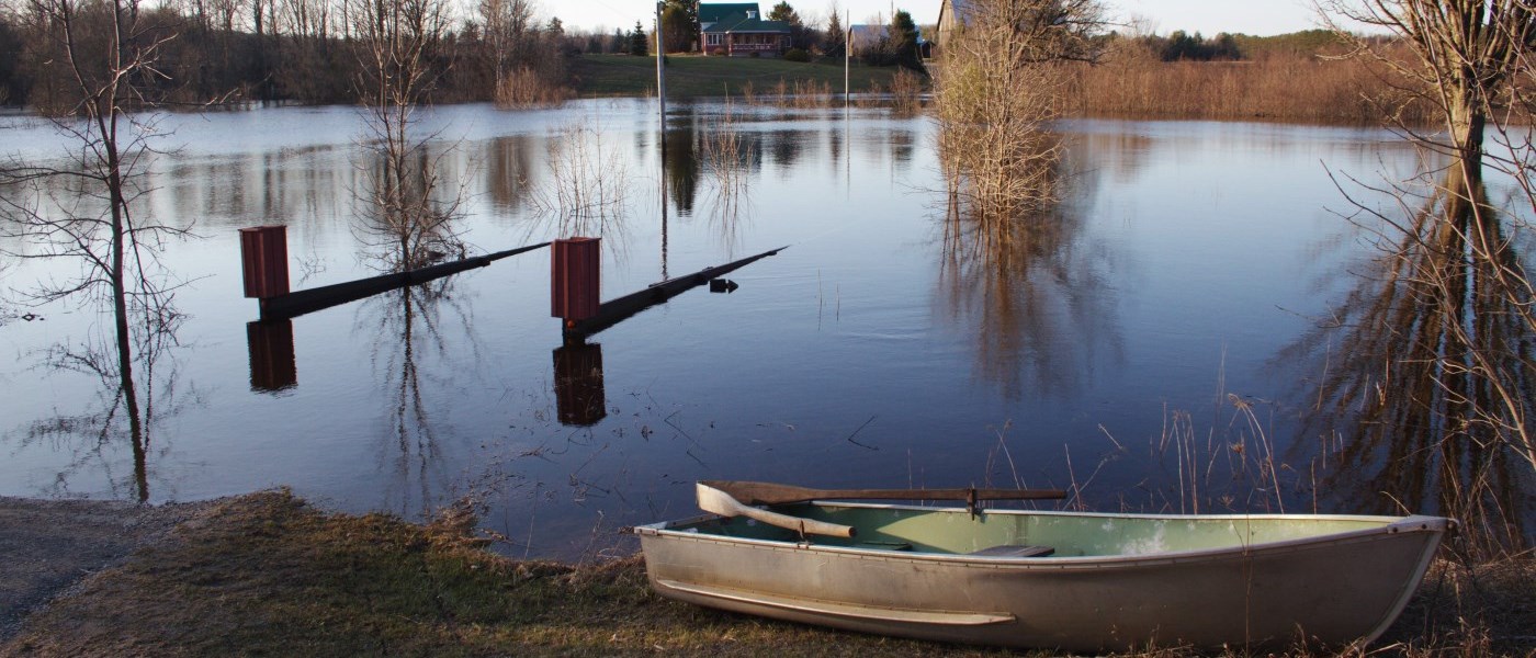
A flood plain is a low-lying area adjacent to a stream, river, or body of water that serves as a natural pathway for water to flow and accumulate during a flood event. These areas act as extensions of waterways, providing space for excess water during periods of heavy rainfall, snowmelt, or other conditions that cause water levels to rise above the banks of the watercourse.
Understanding flood plains is essential for effective flood management and land-use planning. By collecting detailed information about ground elevation, land use patterns, rainfall and snowmelt data, and the presence of infrastructure such as culverts and bridges, we can create accurate models of how water moves during significant flood events. These models also incorporate stream profiles to predict how water will interact with the landscape, allowing us to map flood plains with precision.
Flood plain mapping helps identify areas at risk of flooding, supports the development of mitigation strategies, and informs decisions about construction, zoning, and emergency preparedness. By studying and modeling flood plains, we can better protect communities, ecosystems, and infrastructure while fostering resilience in the face of extreme weather events.

How is floodplain mapping useful?
At Kawartha Conservation, we use floodplain mapping to support regulations that limit existing and new development inside the flood plain to protect your personal safety and property from flood hazards. Your home may already exist inside a flood plain. Our mapping can help you determine how much of your property is at risk and decide which hazard prevention measures to take.

Floodplain mapping study areas
Burnt River drains a very large area north of Cameron Lake and flooding occurs commonly on this river.
This water course drains rural lands west of Dunsford before flowing through the village and then along and under County Road 36 before entering Emily Creek south of County Road 36.
Located north of the Fenelon River, this creek drains both rural and urban areas to the Fenelon River upstream of the Falls at Lock 34. This watercourse also has a large enclosed section from Francis Street to the river outlet below the falls.
Located on the south side of Fenelon Falls this water course drains urban lands into the Fenelon River.
The Mariposa Brook has a large watershed which primarily drains rural agricultural lands. Two large sections of the brook join immediately downstream of the village of Little Britain, and just north of Little Britain Road.
McLarens Creek drains an area of land from Goose Lake through the Village of Cambray and outlets to Sturgeon Lake after crossing Highway 35. A small dam also exists within the village north of Cambray Road.
Miskwaa Ziibi River drains a moderately large area north County Road 36 and outlets at its southern extents into Little Bald Lake.
Nogies Creek is located approximately 5 km northeast of Bobcaygeon. The Creek drains a moderately large area north of County Road 36 before it outlets at its southern extents into Pigeon Lake.
- Nogies Creek Floodplain Mapping Study Technical Report
- Nogies Creek Floodplain Mapping Study Flood Map 1
- Nogies Creek Floodplain Mapping Study Flood Map 2
- Nogies Creek Floodplain Mapping Study Flood Map 3
Full size maps available upon request.
This creek drains rural lands east of Omemee and south of Highway 7 and outlets to the Omemee Mill Pond after crossing Queen Street South.
Located north and west of the Town of Lindsay, this area drains both urban and rural lands to the Scugog River.
Located northeast of the Town of Lindsay, this area drains both urban and rural lands to the Scugog River. This creek has several crossings in the Colborne Street East area of town and runs through Rivera Park before entering the Scugog River downstream of the Lindsay dam.
Contact Us
Kawartha Conservation
277 Kenrei Road
Lindsay, ON K9V 4R1
Tel: 705.328.2271
Fax: 705.328.2286
Subscribe to Receive Updates and Notifications
Stay up to date on flood and low water, news, activities, events, programs and operations by subscribing to updates and the Watershed Watch Newsletter.
